Mapping the Moon
through the ages
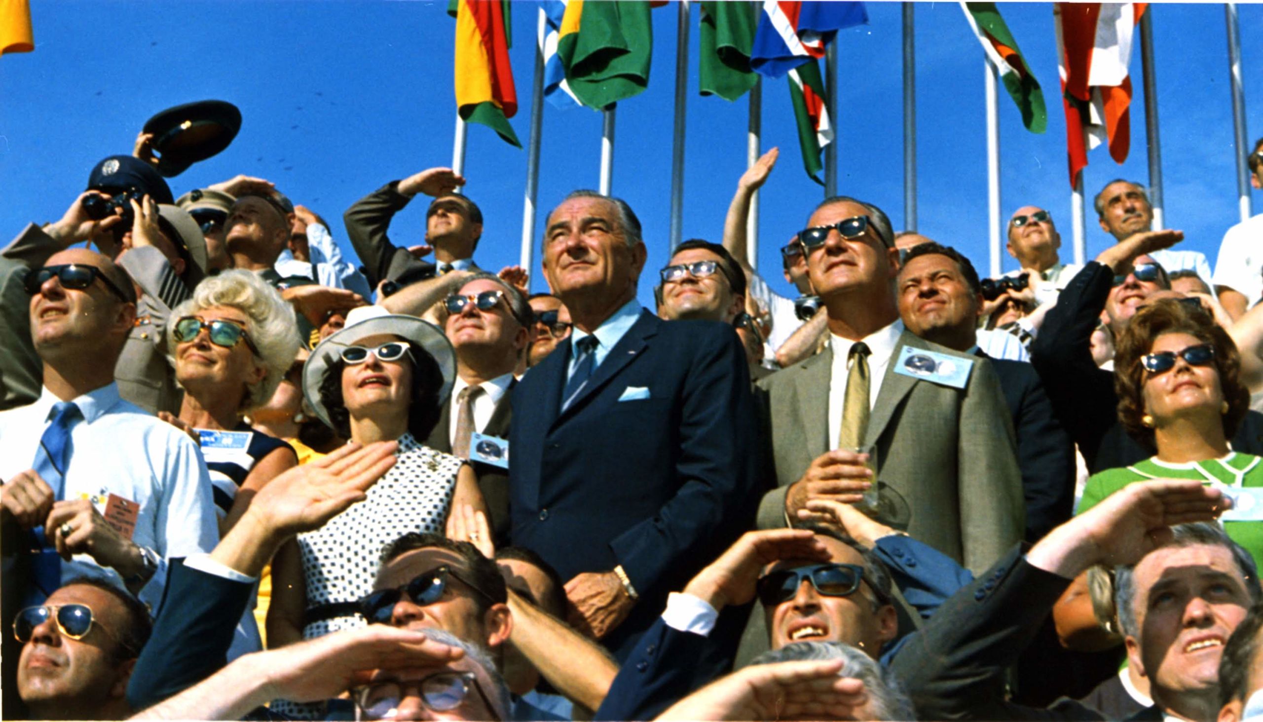

Apollo 11 launched on July 16, 1969 from Cape Kennedy, carrying Commander Neil Armstrong, Command Module Pilot Michael Collins and Lunar Module Pilot Edwin "Buzz" Aldrin into an initial Earth-orbit. An estimated 650 million people watched Armstrong's televised image and heard his voice describe the event as he took "...one small step for a man, one giant leap for mankind" on July 20, 1969.

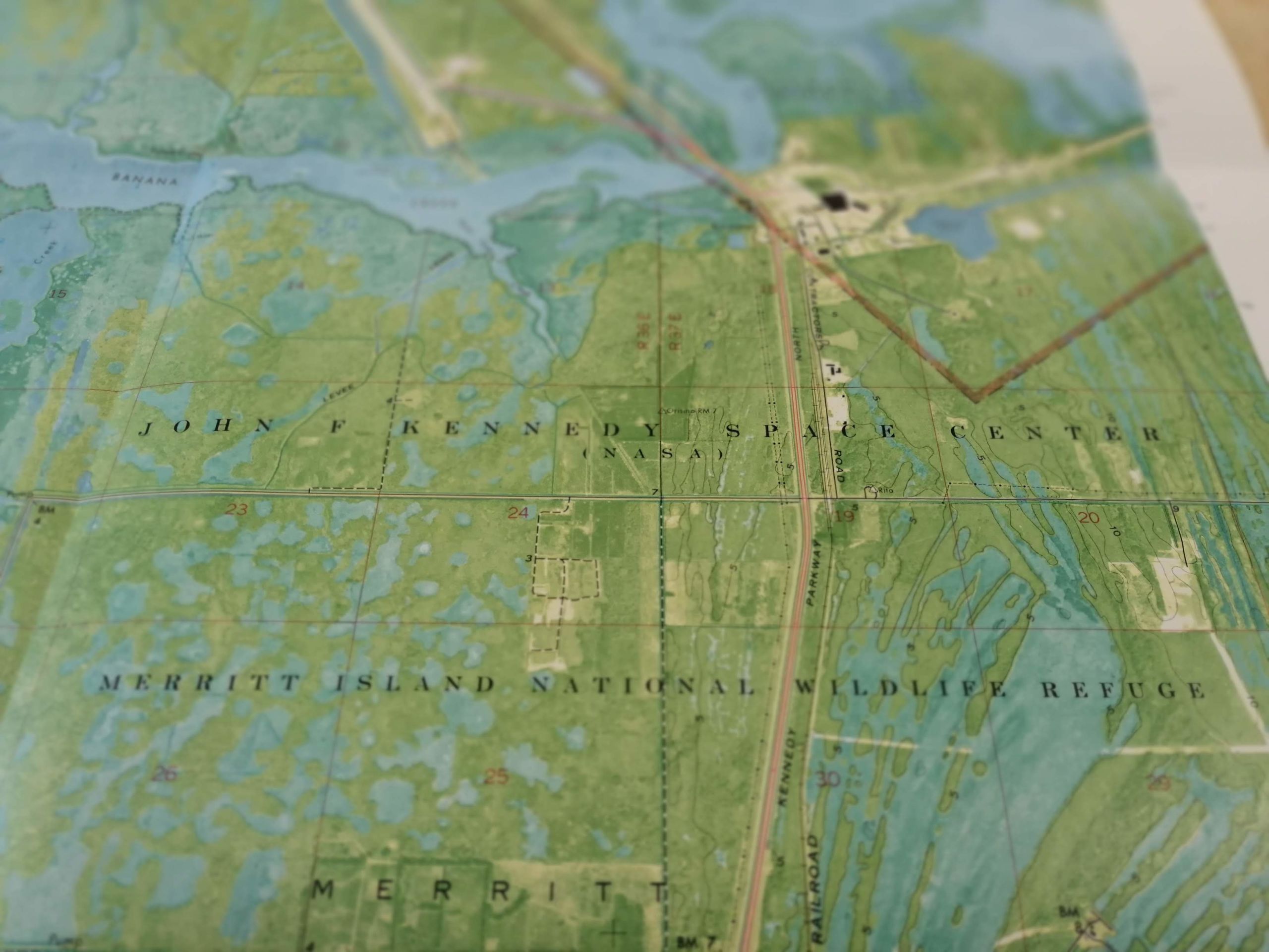
An extract from an USGS 1:24,000 scale map showing the Launch Control Center at John F Kennedy Space Center on Merritt Island, Florida. Maps.670.01 Orsino, 1976. Photo Credit: Priyanka Pais
An extract from an USGS 1:24,000 scale map showing the Launch Control Center at John F Kennedy Space Center on Merritt Island, Florida. Maps.670.01 Orsino, 1976. Photo Credit: Priyanka Pais
The journey was made possible by the careful deconstruction of the Saturn V rocket and Apollo spacecraft. It took 8 days, 3 hours, 18 minutes and 35 seconds, relying on carefully executed mid flight manoeuvres. The final landing on the lunar surface was made possible by a coordinated descent process, and eventually led to the first spacecraft launch from surface other than Earth.
It was a thin slice of history that allowed humankind to look at itself differently. Although this event was monumental, we as a species have been recording, researching and documenting the moon through the ages.
Hints of future frontiers for space exploration in our collections
These images are from Andreas Cellarius’s celestial atlas “Harmonia macrocosmica”, an atlas of the stars published in 1661.
It is one of the masterpieces of the Dutch Golden Age of cartography and maps the structure of the heavens in twenty-nine exquisite plates.
A Chinese Map of the Stars
“Tianwen tu”, a map of the stars, originally made in about 1190 by Huang Shang for presentation to the Song Emperor in 1194.
The original map is now lost but in 1247 a copy was engraved on a stone stele and it is a 19th century rubbing from this stone copy that is pictured here.
Researching the Moon
The mission was the culmination of years of research and preparation, and the pinnacle of the so-called “space race” between the United States and the Soviet Union. This rivalry lasted many years in which both sides competed for dominance in space exploration.

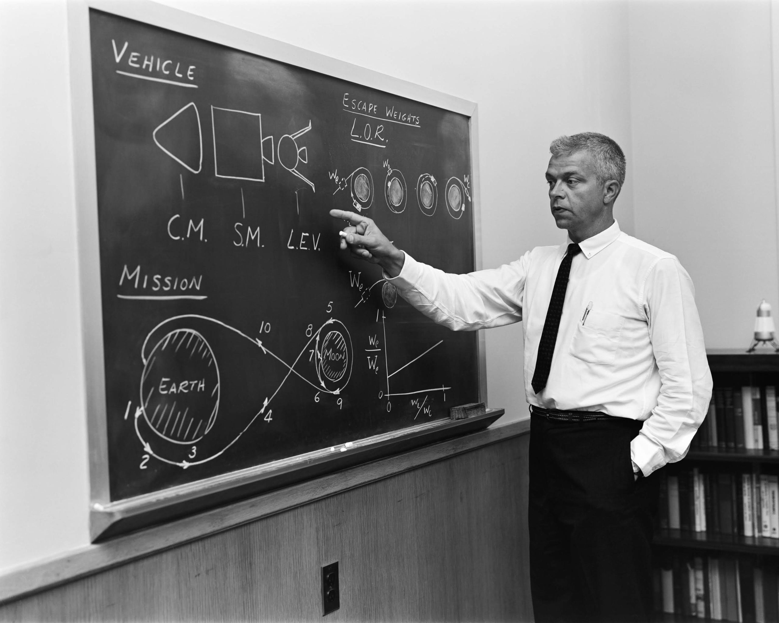
John C. Houbolt at blackboard, showing his space rendezvous concept for lunar landings. Lunar Orbital Rendezvous (LOR) would be used in the Apollo program. Date: July 24, 1962. Photo credit: NASA.
John C. Houbolt at blackboard, showing his space rendezvous concept for lunar landings. Lunar Orbital Rendezvous (LOR) would be used in the Apollo program. Date: July 24, 1962. Photo credit: NASA.
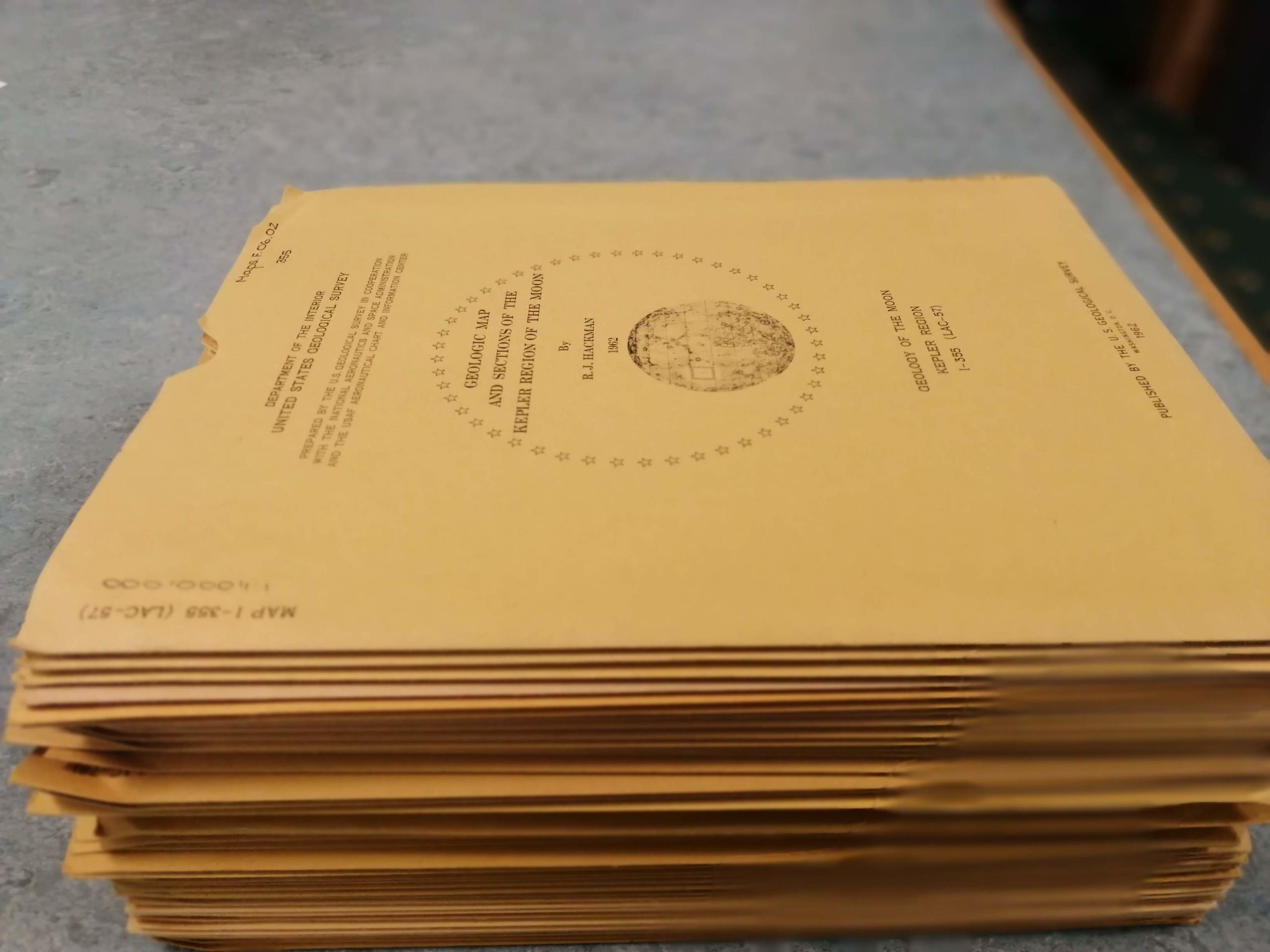
Part of this research included the United States Geological Survey, along with NASA, producing and publishing hundreds of geological maps of potential early Apollo landing sites on the moon. The picture to the right illustrates only a fraction of the maps produced to document the topography, geology and topology of the moon. Most of these maps can be found in the Map Department collection here at the University Library.


As well as the hundreds of geological maps of the moon that NASA produced, there are also very many photographic documents taken during the 1964-1965 NASA Lunar Ranger Program.
Ranger VII, Ranger VIII, and Ranger IX mission images have been published.
Caution: The following video contains rapidly flickering images.
Ranger VIII: Photographs of the Moon, NASA. 1966. Atlas.5.96.238 & Ranger IX: Photographs of the moon, NASA. 1966. Atlas.5.96.239
Ranger VIII: Photographs of the Moon, NASA. 1966. Atlas.5.96.238 & Ranger IX: Photographs of the moon, NASA. 1966. Atlas.5.96.239
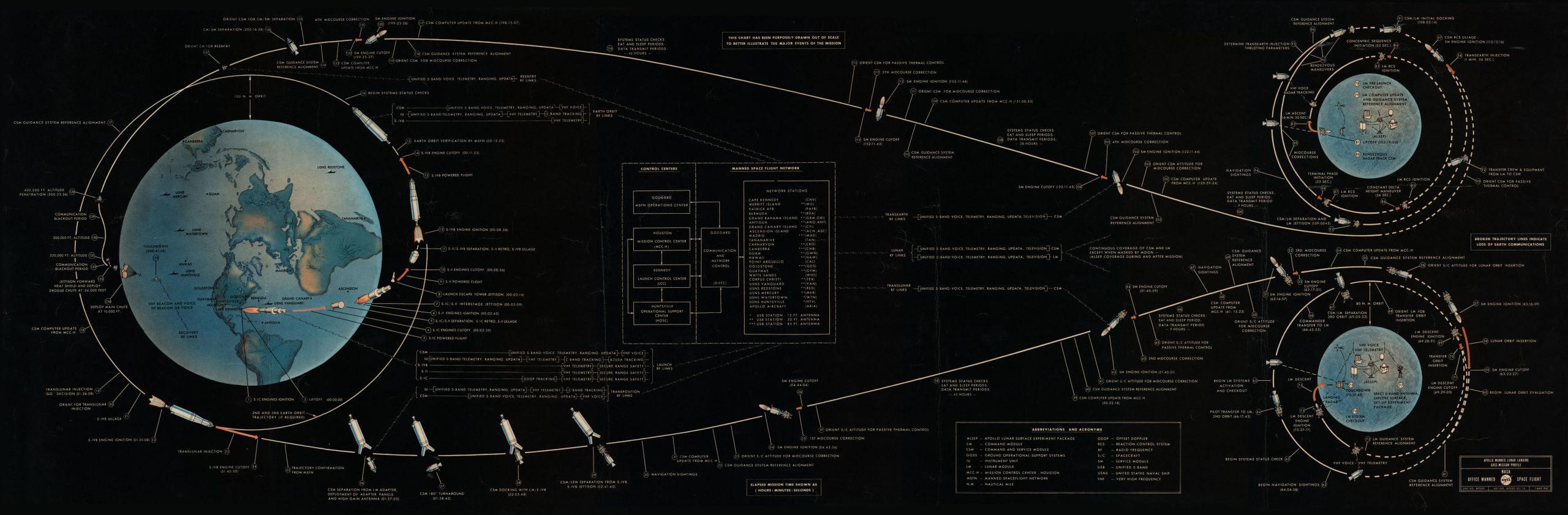
The Flight path of Apollo 11
Components of Saturn V were discarded one by one. The way they came apart made the moon landing happen. 2 hours, 44 minutes and one-and-a-half revolutions after launch, the S-IVB stage reignited for a second burn of 5 minutes, 48 seconds, placing Apollo 11 into a translunar orbit.
The command and service module, or CSM, Columbia separated from the stage, which included the spacecraft-lunar module adapter, or SLA, containing the lunar module, or LM, Eagle. After transposition and jettisoning of the SLA panels on the S-IVB stage, the CSM docked with the LM. The S-IVB stage separated and injected into heliocentric orbit 4 hours and 40 minutes into the flight.
The first colour TV transmission to Earth from Apollo 11 occurred during the translunar coast of the CSM/LM.
Later, on July 17, a three-second burn of the SPS was made to perform the second of four scheduled midcourse corrections programmed for the flight. The launch had been so successful that the other three were not needed.
On July 18, Armstrong and Aldrin climbed through the docking tunnel from Columbia to Eagle to check out the LM, and to make the second TV transmission.
On July 19, after Apollo 11 had flown behind the moon out of contact with Earth, they performed the first lunar orbit insertion manoeuvre. At about 75 hours, 50 minutes into the flight, a retrograde firing of the SPS for 357.5 seconds placed the spacecraft into an initial, elliptical-lunar orbit of 69 by 190 miles.
Later, a second burn of the SPS for 17 seconds placed the docked vehicles into a lunar orbit, which was calculated to change the orbit of the CSM piloted by Collins. Before this second SPS firing, another TV transmission was made, this time from the surface of the moon.
On July 20, Armstrong and Aldrin entered the LM again, made a final check, and at 100 hours, 12 minutes into the flight, the Eagle undocked and separated from Columbia for visual inspection. At 101 hours, 36 minutes, when the LM was behind the moon on its 13th orbit, the LM descent engine fired for 30 seconds to provide retrograde thrust and commence descent orbit insertion, on a trajectory that was virtually identical to that flown by Apollo 10. At 102 hours, 33 minutes, after Columbia and Eagle had reappeared from behind the moon, a powered descent initiation was performed with the descent engine firing for 756.3 seconds. After 8 minutes, the LM was at "high gate" about 26,000 feet above the surface and about five miles from the landing site.
The descent engine continued to provide braking thrust until about 102 hours, 45 minutes into the mission. Partially piloted manually by Armstrong, the Eagle landed in the Sea of Tranquility. This was about four miles downrange from the predicted touchdown point and occurred almost one-and-a-half minutes earlier than scheduled. It included a powered descent that ran a mere nominal 40 seconds longer than preflight planning due to translation manoeuvres to avoid a crater during the final phase of landing. Attached to the descent stage was a commemorative plaque signed by President Richard Nixon and the three astronauts.


'The Eagle has landed'
The lunar module touched down in Mare Tranquillitatis shown here on this 1742 edition of 'Atlas Coelestis', which translates to 'Atlas of the sky'.
The image below is of one of the maps in a volume published by Johann Gabriel Doppelmayr (1677-1750). The second image is 'The handy map of the Moon' published in 1886 and the third, is a NASA Lunar Earthside chart. All these maps show iterations of the lunar landing site documented at different points in history.
Making Headlines
While all this was happening, the entire world was reporting on this event. Newspaper archives here at the Library show what local and national reporters were saying about the moon landing.
Local Advertising
Many small businesses used moon references to advertise their services. We dug up a few quirky adverts from local Newspaper archives at the time.
Back down to Earth
After a three week quarantine following their return to Earth the astronauts embarked on a 45-day "Giant Leap" tour that saw their accomplishment heralded across the globe.
The astronauts went to 25 foreign countries and visited with prominent leaders including the Queen.
