Cambridge University Library has one of five known sets of proof maps prepared for John Speed's Theatre of the Empire of Great Britaine (Atlas.2.61.1), which was published in 1611/12.
The maps were printed from copper plates which had been engraved, in reverse, by Jodocus Hondius in his workshop in Amsterdam. Maps printed from the plates - proofs - would have been sent back to England for checking.
The maps in Cambridge University Library's set of proofs - known as the Gardner copy after Dr Eric Gardner (1877-1951) the former owner - are in a late state of preparation, but many were altered before being published. The map of Cheshire, which had been produced as early as 1603 by English engraver William Rogers, was completely replaced for publication and only two copies of the proof map of Cheshire are known to exist.
None of these proof maps have text on the reverse. (The text on the reverse of published maps can sometimes be used to narrow the date of publication since the text was sometimes reset between editions).
All 66 maps are now viewable in the Cambridge Digital Library
Images are available for download for non-commercial purposes (licensed under a Creative Commons Attribution-NonCommercial 3.0 Unported License (CC-BY-NC 3.0))
The original maps measure approximately 40 x 53 cm (16 x 20.5 inches ; = A2 or 2 x A3).
For more information on John Speed's proof map see the blogs:
- Speed maps now in the Cambridge Digital Library (23 March 2015)
- A Theatre of Treasures (11 October 2016)
Also of interest may be:
- Biography of John Speed from Map Forum. (See also on the Wayback Machine : Biography, John Speed ; Biography, John Speed II ; Biography, John Speed III)
- Beginner's Guide : colouring on antique maps
- Beginner's Guide : Printing (MapForum on Wayback Machine) or http://www.baynton-williams.com/Printing-Techniques.htm
- Information on Speed's map of Hampshire can be found on the Old Hampshire Mapped website
Information on Dr Eric Gardner, the former owner of our proof maps, can be found at:
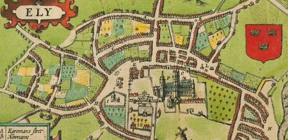
Image credit: extract of Ely from Speed's Huntingdonshire Atlas.2.61.1